vRTK GNSS RTK System
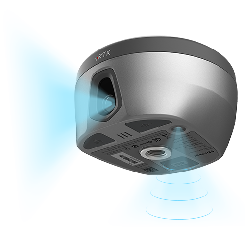
Equipped with professional dual cameras, vRTK is Hi-Target’s first lightweight and innovative visual RTK receiver product, which not only enables non-contact image surveying, breaking through the objective constraints of previous work, but also improves the speed of stakeout with the function of Live View Stakeout. It greatly improves the work efficiency of engineering users.
Dual Cameras for Image Survey and Live View Stakeout
Non-contact measurement greatly improves the usable range of GNSS and efficient safe operation.

Strong Signal and High-quality Data
- New generation GNSS SOC chip with 1408 channels, supports new frequency points B1C, B2a, and B2b RTK decoding for Beidou-3 Satellites.
- Introduction of multi-frequency anti-jamming technology and multi-step adaptive filtering technology to ensure strong signals, high-quality data, fast fix, and high accuracy.

Abundant Industry Data Results
- Abundant types of data results meet the needs of different industry applications.
- Compatible with the mainstream modelling software to attain point cloud and 3D modelling in one step.

Product Parameters
8mm+0.7mm/°tilt
Tilt Survey Accuracy
BDS/GPS/GLONASS/GALILEO/ QZSS/NavlC/SBAS
Satellite Tracking
2cm ~ 4cm
Image Survey Accuracy
1408/1760
Channels
2cm
Image Stakeout Accuracy
Built-in 8GB ROM
Data Storage
Send an Inquiry
Videos
Seeing is Believing-Visual Positioning Technology Empowers the Hi-Target vRTK
Geofield is dedicated to quality, professionalism and ethics with strong commitment to exceed our client’s expectations.
Office
No. 44 Chime Avenue, New Haven, Enugu.