CHCNAV Apache 4

Highlights
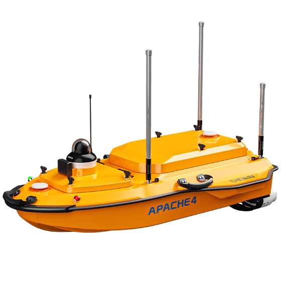
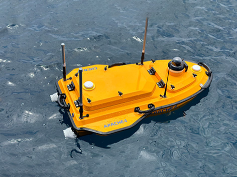
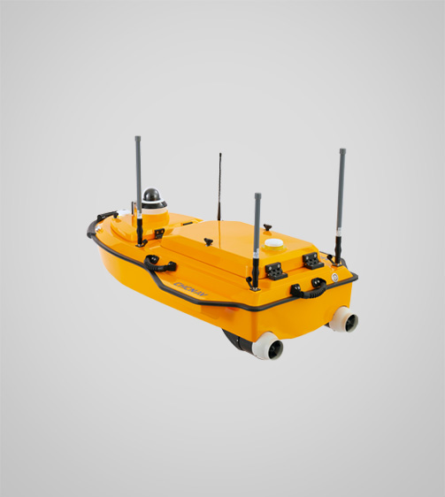
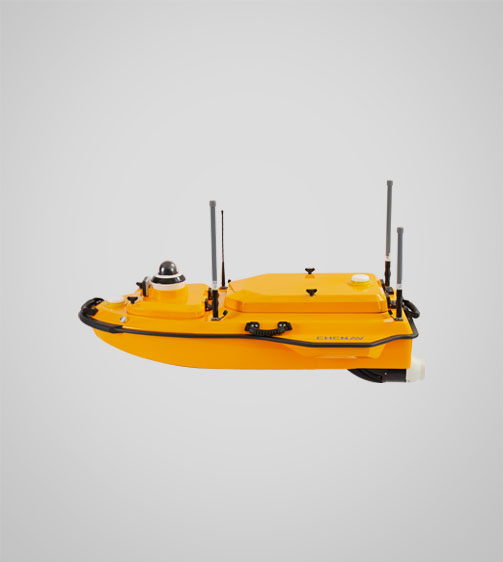
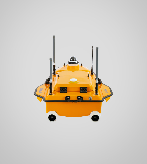
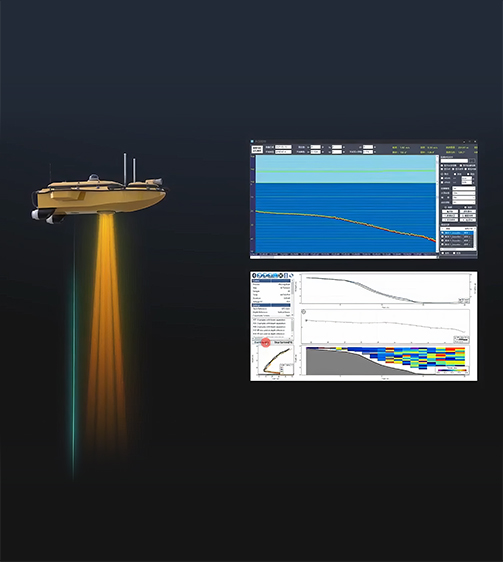
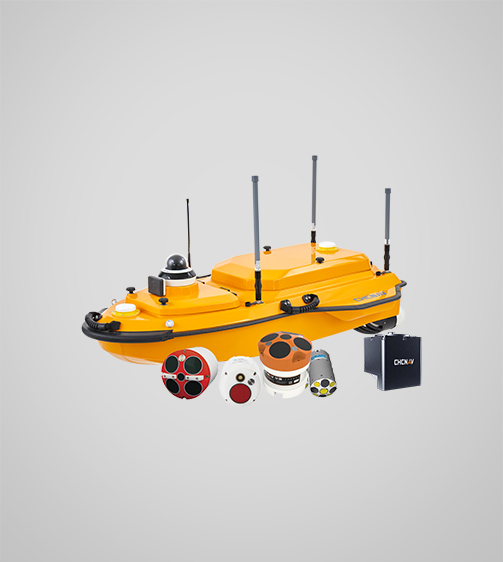
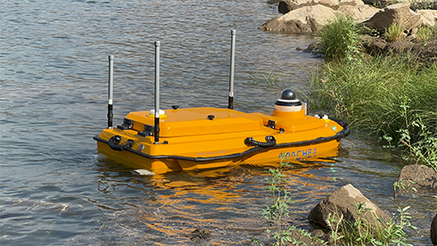
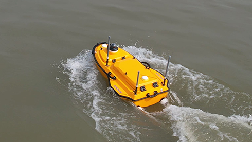
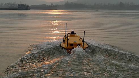
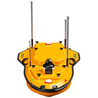
The APACHE 4 USV is optimized for hydrological studies, supporting a range of ADCP and compact multi-beam systems. Its shallow draft, high accuracy, and stable hovering make it ideal for measuring water flow velocity and discharge. Compact and easy to handle, it ensures effortless site management, safe launches, and convenient car transport. With integrated GNSS+IMU technology, it provides reliable positioning and heading, enhancing ADCP and autopilot functionality for precise water flow analysis.

Main Features

Configurable Platform
Available with a selection of different sensors.

GNSS+IMU
Accurate positioning and heading data.

Android OS
Android software for hydrological and bathymetric surveys.

Lightweight
13 kg for single-operator deployment.
Benefits and Performances
01 Efficient Hydrographic Surveying
Perform high-quality flow and velocity measurements with stable GNSS positioning and automated navigation. Ideal for hydrologists conducting ADCP hydrographic cross-section flow measurements.
02 Accurate Even Under Bridges
Maintain high accuracy under bridges with integrated GNSS and IMU sensors. The Apache 4 provides precise position and attitude data, compensating for hull sway and eliminating data outliers during GNSS outages.
03 Versatile Instrumentation Compatibility
With its central access shaft design, the APACHE 4 supports ADCPs such as the CHCNAV RS Series, M9, RTDP 1200, RiverPro and RiverRay. It also accommodates the CHCNAV HQ compact multibeam echosounder, side-scan sonar and water quality probes for end-to-end surveys.
04 Integrated Single-Beam Echosounder
Verify ADCP bottom-tracking data using the built-in single-beam echosounder. It provides water depth profiles in conjunction with flow velocity measurements, significantly extending the ADCP’s sounding range.
05 Advanced Navigation Controller
Navigate accurately along cross-sections with adaptive water flow technology. The hovering feature improves flow estimation accuracy by maintaining stability at observation points, even in turbulent conditions


Use Cases

Flood Risk Assessment

Sediment Transport Studies

Port Current Analysis

River Discharge Measurement


Detailed Specifications

CHCNAV Apache 4
Hydrographic and Bathymetric Surveys USV
Performances
- Speed max. : 6 m/s
- Payload capacity : Up to 35 kg
- Draft : 12 cm
- Positioning : Full GNSS + IMU
ADCP
- Type : CHCNAV RS600/1200
- Transducer : 5 beams
- Accuracy : ±0.25% ±2 mm/s
Echosounder
- Type : Single beam, 200 kHz
- Range : 0.15 to 200 m
- Resolution : ±0.01 m + 0.1% x D
Sensors
- Camera : 360° video
Download
Send an Inquiry
Geofield is dedicated to quality, professionalism and ethics with strong commitment to exceed our client’s expectations.
Office
No. 44 Chime Avenue, New Haven, Enugu.